Fletcher Creek Ride

This tributary of Mills River has many popular trails in its watershed. This ride features a difficult climb, ridge riding, a very steep and technical downhill, technical singletrack, and gravel road cruising. It also includes the awesome Fletcher Creek singletrack trail, which is a fast downhill through lush forests and open fields. Also be sure to check out the Hendersonville Reservoir and Dam for scenery.
At A Glance
 8.4 mi round-trip
Difficulty Rating: 12.38 ![]()
Tread Condition: Very Rough ![]()
Climb: Climbs Steeply ![]()
Lowest Elevation: 2400 ft
Highest Elevation: 3475 ft
Climb Total: 1200 ft
Configuration: Loop
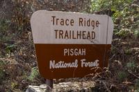
Starting Point: Trace Ridge trailhead
Trails Used: Fletcher Creek, Spencer Branch, Trace Ridge
Directions
From Asheville, take I-240 west to I-26 east. Take Asheville Airport exit (exit 40) and go south (right) on NC 280. Just past intersection with NC 191, make a right at the stoplight and Ingles supermarket onto North Mills River Road and follow signs to the North Mills River Recreation area. Just past North Mills River Recreation Area parking lot, make a right onto Wash Creek Road, FS 479, which is now paved for the first 1/4 mile or so. Follow this for just under 2 miles. Turn left onto the un-gated gravel road which has a concrete low-water bridge, and follow this 0.5 mile to the Trace Ridge trailhead and parking lot.
Details
Ride Description
Note 1: The Forest Service has completed a logging project in this area, which involved re-constructing the lower part of the Trace Ridge trail, which is an inventoried road. Watch for changes to the trail since the project.
Note 2: The upper portion of the Spencer Branch trail has been re-routed around the steep section that drops from Trace Ridge. Mileages will be slightly longer than indicated.
Start out the ride by passing over several large bulldozer-created humps on the Trace Ridge trail. The trail levels out onto an old roadbed. But it soon veers steeply uphill to begin its climb up the ridge. The next 2.3 miles are mostly climbing with four long, steep, technical sections, interspersed with short, level or slightly downhill sections.
The surface is variable. Loose rocks will cause your tires to slip in some places, while windblown piles of leaves hamper your climb in others. The climbs are fairly steep, but mostly rideable. Large water turnouts were bulldozed into the trail in April 2001, making it more uneven. The trail will pass over a large rock slab and top out at about 3480' elevation.
After the top of the ridge, the trail begins a loose rocky downhill, through the ridgeline pine-oak forest, and mountain laurel shrubs. At the bottom of this short downhill stretch is the intersection with the Spencer Branch trail, where you'll turn left.
In times past, the Spencer Branch trail plunged straight off the side of the ridge onto one of the most technical stretches of trail in the area. However, as of October 2015, this trail has been re-routed onto a more gradual side-hill descent with a few switchbacks. It is more of a flowy trail now, although it does have a few technical features and rock gardens to spice it up. Near the bottom, where the trail levels out, you'll cross a new bridge before reaching Fletcher Creek Road (FS 5097).
This road is a gravel cruiser. It is also known as the Neverending Road because it seems to go on forever. Spencer Gap trail goes straight across, but don't take that: turn right here. Don't worry: you'll only ride a mile long section of Neverending Road that will climb and then descend gently to an intersection with the Fletcher Creek trail.
Turn left here. You'll begin a great downhill. It's not very steep, but it's fast with enough rocky, rooty, and wet sections to spice it up. The singletrack is tight in places, and it passes through some interesting fields on its way. In recent years, some erosion problems and mud holes have cropped up along this section of trail, but it's also received some maintenance work, so conditions may vary.
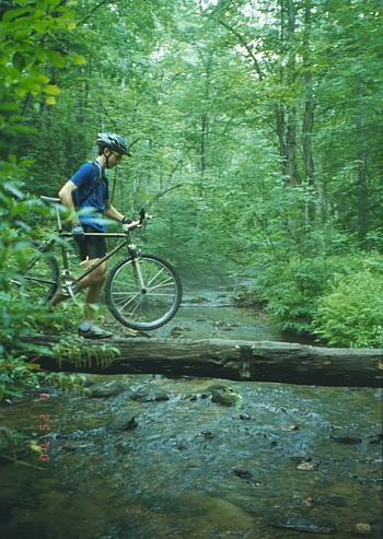
You'll emerge at the intersection with the Spencer Branch trail again. Both trails share a wide crossing of Fletcher Creek here. You can either ride straight across, or take a chance and go downstream a few hundred feet on a fern-lined trail to see if there is a log bridge. Note: this log bridge was washed away during the floods of September, 2004. It may or may not be replaced.
Pick back up on the Fletcher Creek trail again on the other side of the creek. The trail continues with a short, moderate uphill. It tops out on this hill and becomes a rocky, fast, thrilling downhill with lots of earthen waterbars and a few good jumps. This trail will shoot you out at high speed onto the Hendersonville Reservoir Road, going in the correct direction to finish the ride. If you would like, however, you can turn right instead and go a few hundred feet to see the Hendersonville Reservoir and dam - a nice little diversion.
To return to the starting point without seeing the dam, make a "left" (basically straight) at this intersection. This fun doubletrack/gravel road will undulate up and down and terminate in the parking lot after a short but tedious climb.
Other Options: This ride is intended to highlight some of the best the North Mills River area has to offer. Many other riding options exist in the vicinity. Check your map if you want a longer ride!
All Photos from This Ride
Ride Landmarks
| Mile | Directions |
|---|---|
| Start | Ride up the Trace Ridge trail, which is to the right of the parking lot as you came in. Ride over the large bulldozed mounds. |
| 0.2 | Trace Ridge trail bears left, steeply uphill. Next 2.3 miles uphill. |
| 2.5 | Top of the ridge. Trail passes over a large rock slab. |
| 2.8 | Intersection with the recently re-routed Spencer Branch trail. Turn left. The next section is downhill. |
| 3.6 | Intersection with Fletcher Creek Road (Neverending Road). Turn right. |
| 4.6 | Intersection with Fletcher Creek trail. Turn left. |
| 5.8 | Intersection with creek and Middle Fork trail. Turn left, cross the creek, and then go straight to pick back up on the signed Fletcher Creek trail (uphill). (Note: to avoid this wet creek crossing, there used to be a log bridge a few hundred feet downstream from this crossing. However, this log was washed away during the floods of September, 2004) |
| 7.1 | Trail merges with Hendersonville Reservoir Road. Turn right and ride a few hundred feet upstream to see the dam, or turn left (basically go straight) to continue the ride on this road. |
| 8.4 | Finish, road terminates in the Trace Ridge trailhead parking lot. |
Map
Green highlight indicates the route to follow within the trail network for this ride.
Tip: Printing this map? You can pan and zoom the map as desired before printing to show the area you need.
Map Information
Download GPS Data
Click on a route, trail, or point on the map and select the GPS Data tab to download its data.
Data Formats
KML (Google Earth)
KML is the main file type used by Google Earth. If you have Google Earth installed, clicking the KML link should open the trail or point directly in Google Earth for viewing. This is the native file format used by Google Earth, but many other map applications can use and understand KML as well, so if you're not sure which one to download, KML is a good bet.
GPX
The GPX format stands for GPS Exchange - a free, open, XML format for exchanging GPS and map data. GPX is compatible with Google Earth, many other mapping programs, and most GPS devices (such as Garmin). Load the file directly into your GPS to help find your way on your next trip!
GeoJSON
GeoJSON is a newer, lightweight data exchange format which can be used to quickly share map data and may have a smaller size than KML or GPX. Many professional mapping and GIS applications support the GeoJSON format.
About the Map
Copyright
Base Layers
Base layers provided by OpenStreetMap, the US Geological Survey, the US Forest Service, and NC OneMap. Base layer images are subject to the respective copyright policies of their owners. Base layers may not be available at all times due to system maintenance or outages.
WNCOutdoors Base Layer
The WNCOutdoors Base layer is provided by WNCOutdoors.info. It is licensed by Creative Commons Attribution 3.0.
Trail and Marker Overlays
Trail layers and downloadable data are all original works created by WNCOutdoors with guidance from a variety of sources, including ensembles of our own GPS tracks, user contributed GPS tracks, official maps and GIS data from government agencies, and field observations. WNCOutdoors data is made freely available under the Open Database License - you are free to copy and use it for any purpose under the terms of that license (summary).
Tips
- Hover over a trail to see it highlighted. Helps to see start and end points for an individual trail.
- Scroll and zoom the map before printing, and that view will persist into the printed image.
- Click a trail for more details and to download it individually.
Feedback
Ratings
Average Rating: 4.5 (rated 2 times)
Rate It Now:

Richard Sandell said: Great ride. The initial climb is tough and long, but it rewards you with some good downhill speed. Watch out for the steep technical downhill that follows on Spencer Branch trail. The rest of the ride continues the fun. Trust you judgement as far as the turn onto Fletcher Creek Road as it is not marked. The rest is marked and the ride that follows proves a few fun climbs followed by some flowing downs. Enjoy.